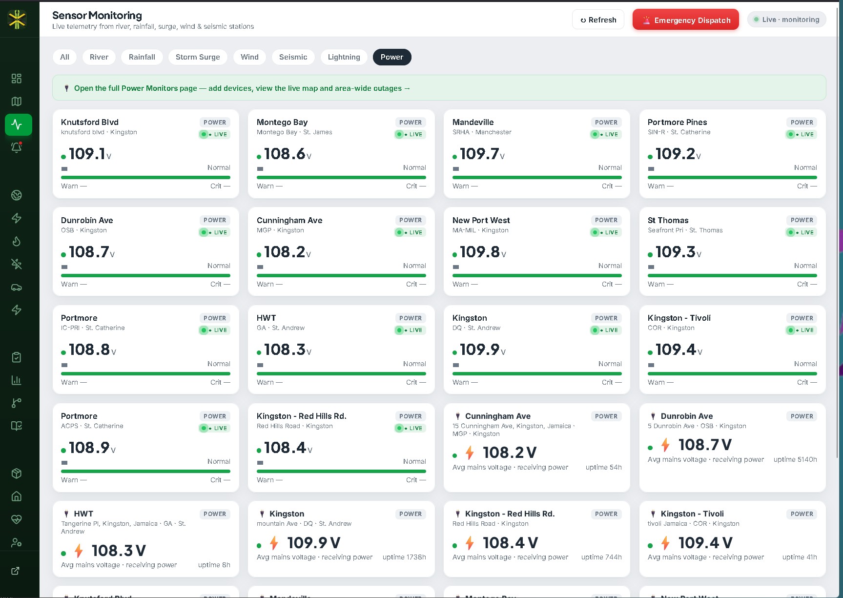
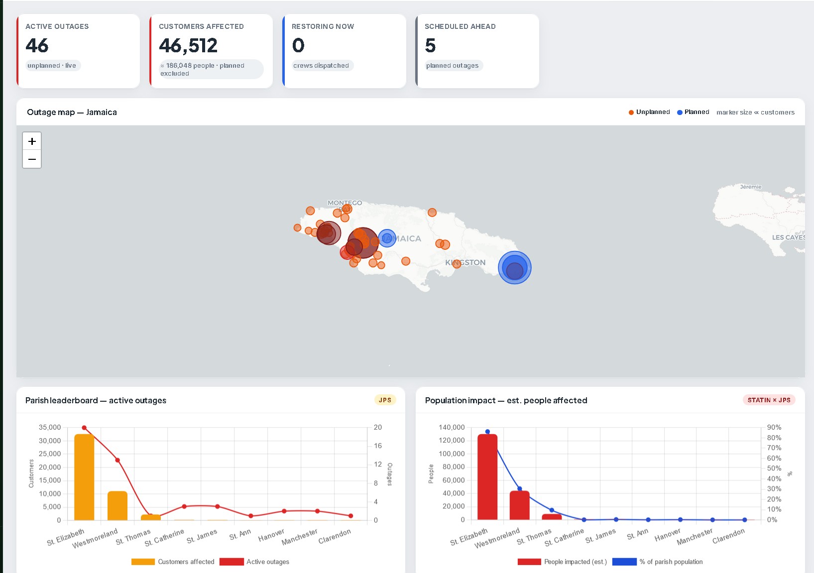
⚡ Power Outage Sensors — 750 needed
Compact, low-power monitoring devices deployed in feeder cabinets, schools, clinics, police posts and community centres across all 14 parishes. The moment mains power drops, the sensor goes silent — DRMS detects the silence within 60 seconds and triangulates the outage footprint against the JPS feed and citizen reports. Outage maps used to be slow and unreliable. With 750 well-placed sensors, Jamaica gets sub-minute coverage of every populated electrical zone.
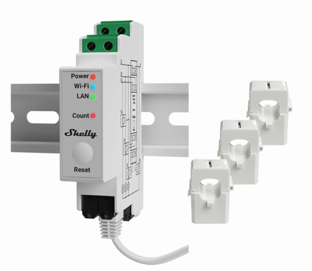
Mains-power monitor
What each unit provides
- Sub-minute detection of mains-power loss at a fixed location
- Tamper alert if hardware is moved or unplugged
- Automatic correlation against JPS feed + citizen reports
- Solar/UPS backup keeps the sensor reporting through the outage itself
Site priorities — where 750 sensors land
- 120 sensors per major-population parish (Kingston, St Andrew, St Catherine)
- 60 sensors per coastal parish (storm-surge / wind-damage hotspots)
- 30 sensors per inland parish
- Critical infrastructure — every hospital, every police post, every primary water utility
🌩 Long-Range Lightning Detection — 6 units needed
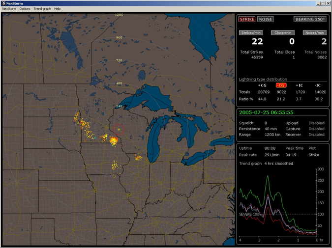
The Boltek LD-350 is a professional-grade long-range lightning detector with a measurement radius of about 500 km — enough that six well-spaced units triangulate every storm cell from the Bahamas chain through Jamaica and down to the Cayman trough. Combined with our existing satellite (NOAA GOES-19 GLM) coverage, the ground-based units provide redundant detection and millisecond timing precision the satellite alone cannot.
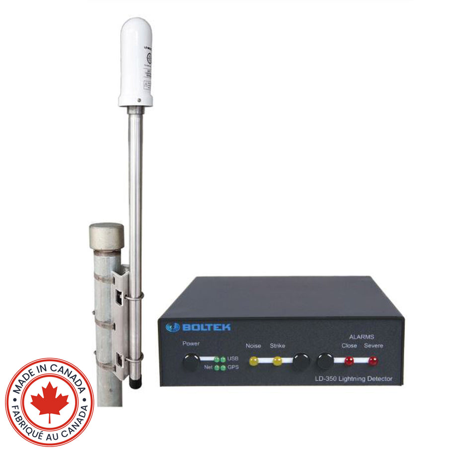
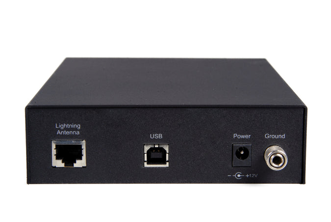
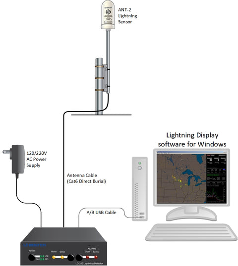
Boltek LD-350
Why six units
- ~500 km detection radius per unit — three give Jamaica full triangulation, six add redundancy + Caribbean-wide coverage
- One unit at each major airport (Norman Manley, Sangster) plus inland Mandeville, Negril, Port Antonio & St Mary
Specifications
What each unit unlocks
- Independent ground-truth alongside the NOAA GLM satellite feed
- Sub-second strike timing for utility lightning-protection forensics
- Severe-weather forecasting (storms typically intensify minutes before a strike spike)
🎥 LPT Cameras — 250 needed for travel-time + speed
Hikvision iDS-2CD7A46G0/P-IZHSY — outdoor-rated 4 MP camera with motorised 8-32 mm lens and on-board ANPR plate recognition. Deployed at 250 strategic intersections across Kingston, Spanish Town, Montego Bay, Mandeville, Ocho Rios, Negril and Port Antonio, the network measures real travel times between gantries and detects vehicles exceeding posted speed — feeding directly into the DRMS traffic engine and the public live map.
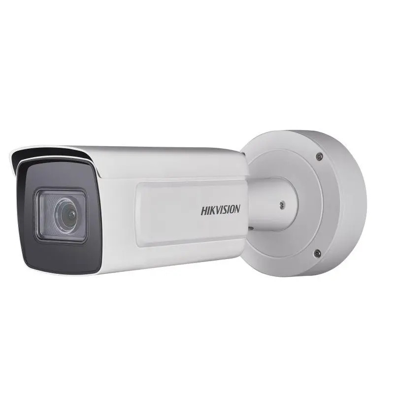
Hikvision iDS-2CD7A46G0/P-IZHSY
Key specifications
Network capabilities
- ANPR — Caribbean plate format recognition on-device, no server load
- Travel time — same plate seen at two gantries = measured journey, used to estimate live congestion
- Speed — frame-to-frame motion estimation at known gantry-to-gantry distance
- Privacy-respecting — only the plate hash is retained beyond 24 h, not the image
Deployment plan
- 140 cameras in Kingston Metropolitan Area
- 40 in Montego Bay corridor
- 30 across Spanish Town & Portmore
- 40 across north-coast tourism belt (Ocho Rios, Negril, Port Antonio)
🌊 Stream & River Monitoring Stations — 100 needed
NexSens cellular telemetry stations with a radar level sensor, water-quality multi-parameter probe and solar power. Deployed on every major Jamaican waterway and at coastal tide-gauge sites for surge measurement, the 100-station network gives DRMS minute-by-minute river stage and quality data — enabling flash-flood warnings minutes before a riverbank is overtopped, and tracking real-time storm-surge against the Cat-1/3/5 tier model.
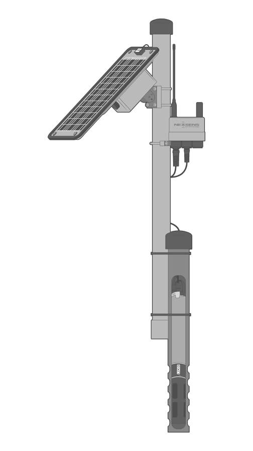
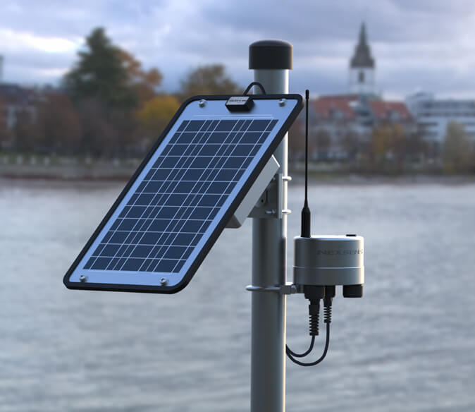
NexSens telemetry station
What each station measures
- River stage — non-contact radar level sensor (±3 mm)
- Water quality — temperature, dissolved O₂, conductivity, pH, turbidity
- Tide / surge — at the 25 coastal sites, captures storm-surge in metres above MSL
- Diagnostics — solar voltage, battery, signal strength
Deployment plan
- 75 river stations on Rio Cobre, Rio Grande, Yallahs, Plantain Garden, Black River + tributaries
- 25 coastal tide gauges (Kingston Harbour, Port Royal, Negril, Ocho Rios, Annotto Bay …)
- Cellular uplink with iridium fallback for hurricane-grade resilience